The price of precision
Posted By David Millar on September 3, 2019 @ 15:23
As Luke Skywalker switched off his computer in the final moments before targeting the thermal exhaust port [1] on the Death Star, we marvelled at the power of the Force and the skill of young Skywalker. We were in on the briefing [2]: ‘An analysis of the plans provided by Princess Leia has identified a weakness in the battle station. The approach will not be easy … The target area is only two metres wide … The shaft leads directly to the reactor system. A precise hit will set up a chain reaction.’ We took for granted the task of analysing an object the size of a moon and identifying the two-metre-square area that needed to be aimed at.
Nowadays, we take such positional wizardry for granted with GPS and Google or Bing Maps guiding us through our daily lives. We program the GPS in our cars, enter an address into Google Maps and wait for a pleasant voice to give us directions to our destination. Benign governments urge us to ‘dial before you dig’ and provide us with centimetric accuracy on the locations of underground power cables and water mains. Farmers use extremely accurate geospatial data to level fields, set up irrigation and harvest their crops.
We expect in the not too distant future to sit inside driverless vehicles that will keep themselves on the road, separate us from each other and deliver us to our destinations faster and more safely. The small problem is that this requires geospatial data and location attributes that are freely available. While the information is provided to the world gratis, some are spending big money to hide it from others. Parallel, unshared systems are also being developed that limit access.
When geospatial data isn’t shared, discovering it and finding out what we need to know become incredibly expensive. The motto of the US National Geospatial-Intelligence Agency is ‘Know the Earth … Show the Way … Understand the World’, and it employs around 16,000 people in an attempt to do so. The Defense Intelligence Agency is another one of the numerous agencies in the US that are involved in locating and identifying the purpose of potential objects of interest. The task also requires at least two constellations of satellites and billions of dollars. This ‘domain awareness’ is fundamental to precision targeting.
We have come to expect precision in modern conflict, from the US and its allies at least, based on the wars of the past three decades. But the precision demonstrated in Operation Iraqi Freedom in 2003 and later missions hides a little-considered critical precursor activity. The UN-sanctioned no-fly zones over Iraq enabled daily data collection and mapping of the region in fine detail. As a colleague wryly observed, ‘If a nation is geospatially poor, declare war on the United States and you will become geospatially rich, quickly.’
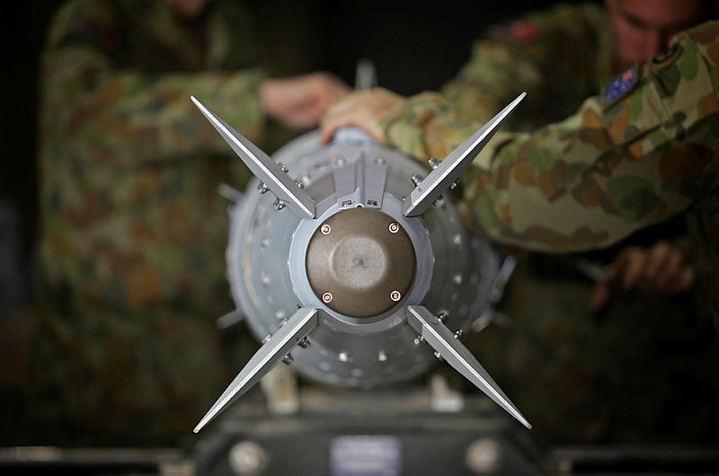
Precision targeting has been achieved through technical advances in weapon aerodynamics, weapon design, laser guidance and more recently the use of GPS weapons like the ‘joint direct attack munition’, or JDAM [3]. ‘One bomb, one target’ became a mantra of Western air forces, and the public has come to expect precision operations where targets are hit, harm is minimised, unnecessary loss of life is prevented—or, in military jargon, ‘collateral damage’ is kept to a minimum.
However, in our focus on future weapons, we can lose sight of the fact that the cost of precision targeting isn’t in the weapons themselves, clever as they may be; it’s in the intelligence that we use to target them.
Even the richest nations can’t afford to spend the resources to ‘know the unknown’ of an entire planet and turn enormous data collections into something useable by smart weapons. And even after years of observation and analysis, we can still get it wrong. The weapons-of-mass-destruction campaign that led to the war with Iraq is a stark lesson in the inability to know the unknown, despite a decade of watching, and even permissive access when demanded. The cost is enormous and largely unrecognised. So whether it’s nuclear facilities in North Korea or baby formula factories in Africa, we will struggle to have all-seeing, all-knowing knowledge of future battle spaces.
To make matters worse, the problem is beyond knowing just a target’s identity and exact location. We need to know more. In daily life we ignore precise elevation. Google may get us to the car park, but it doesn’t tell us what level we parked on. Precision weapons demand precise elevation, particularly in steep terrain, as we saw in India’s air strike [4] on Balakot in Pakistan.
Nor do maps and images give us an object’s true purpose and function, such as the significance of Skywalker’s thermal exhaust port. Imagine having to know this for every target, then add analysing the surrounding neighbourhoods for places that are off limits, such as schools, markets and places of worship.
After that, if a place is determined to be a potential target, information about its structural design needs to be gathered. Where are the doors, the windows, the power supply? Who works there, and what is their work pattern? Are there environmental or cultural issues associated with the site? What are the dependencies and relationships of the potential target with other elements in a target system? If the target is a fuel depot, might it be easier to create a better effect by attacking the storage facilities, power supply or pumping station, or the pipelines that carry the fuel to the enemy for military uses?
Australia’s share of the targeting enterprise bill has never been revealed. Major exercises that demonstrate precision use a small number of rigorously surveyed impact areas in designated ranges. Our war experience over the past five decades has been in coalitions with the United States, which has provided the vast bulk of our intelligence support, packaged in coalition air task orders.
The US National Geospatial-Intelligence Agency with its 16,000 staff is bigger than the entire Royal Australian Air Force—and that’s without taking into account the myriad other agencies and military personnel involved in the US targeting enterprise. Ever-increasing collection of geospatial data in forms such as imagery, radar and laser mapping is of little consequence without an understanding of the bill for analysis and sharing of data.
The cost to produce global-scale target intelligence to support ‘precision-guided’ munitions needs to be factored into Australia’s defence budgets. Costing precision may identify a bill we can’t afford. Unfortunately, we can’t follow Skywalker’s example and turn off the targeting computer and use the Force. We will need to collectively review and budget our geospatial appetites against our needs, because what we want might be beyond our capability, capacity and budget—no matter how many fifth-generation platforms or networked weapons we plan to acquire.
Article printed from The Strategist: https://www.aspistrategist.org.au
URL to article: https://www.aspistrategist.org.au/the-price-of-precision/
URLs in this post:
[1] thermal exhaust port: https://research.arizona.edu/stories/death-star-thermal-exhaust-port-design
[2] the briefing: https://www.facebook.com/TheSWU/photos/a.109062562466825/1362025273837208/?type=1&theater
[3] JDAM: https://www.military.com/equipment/joint-direct-attack-munition-jdam
[4] air strike: https://www.aspistrategist.org.au/were-indias-airstrikes-in-pakistan-a-strategy-for-public-approval/
Click here to print.