Pictures from satellites are pretty useful, especially for disaster relief. And the more data, the better, so Asian nations have a mechanism for sharing their images.
A problem is that most Asian nations are not using the data as well as they could be, because of technical and organizational challenges. But that should not be a problem, because expertise for full exploitation of satellite images is readily available among the four members of the Quad—Australia, India, Japan and the United States.
So, those four countries should establish a training program to heighten Asian expertise and thereby ease the suffering caused by earthquakes and floods. Doing so would also help Asian nations prepare for climate change. Indeed, improving disaster readiness is already part of the mission of the Quad partnership.
Satellites can provide images of oil spills, rising floodwater, fire fronts, shattered roads, and collapsed buildings. Their pictures can also help in disaster preparation through historical analysis to predict what might happen next time. For example, observation of geological characteristics can reveal risks of mudslides.
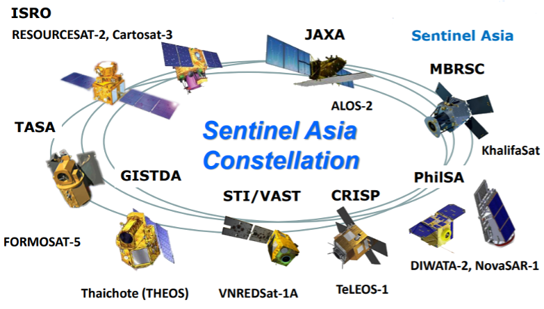
The information that Asian nations uses comes from their own satellites and from commercial space operators they have under contract. They voluntarily share through a joint organization called Sentinel Asia.
Proposed by the Asia-Pacific Regional Space Agency Forum in the aftermath of the 2004 Indian Ocean Tsunami, Sentinel Asia uses Earth observation satellite data and geospatial analysis to enhance disaster management. Its work includes pre-disaster hazard mapping, early warning, and emergency observation and analysis.
It includes 97 member organisations from 29 countries (including Australia, India, and Japan) and 17 international organisations. Geospatial information shared through this mechanism goes to member entities, mainly space agencies.
Technical factors make satellite-observed geospatial information challenging to use. For example, an orbiting synthetic-aperture radar can observe an area at night and through clouds, but picking out features from its pictures requires expertise. Then a different set of skills is required to understand the implications for future disasters revealed in a series of radar, optical, or infrared images.
A Quad-supported training program would not replace Sentinel Asia; instead, it would increase regional proficiency and effective use of data assembled through the Asian organisation.
It would particularly promote Asian nations’ whole-of-government geospatial technical capacity and understanding. Key tasks would be building a geospatial foundation while demonstrating the practical application of satellite support and information processing in disaster preparedness and management. This would include education on imagery exploitation techniques, analytical methods, and information dissemination strategies.
The program would expose trainees to available regional geospatial resources and the benefits of civil-military geospatial coordination. Fostering such interagency coordination and communication is critical to effective disaster management.
Each Quad nation should incorporate the training into existing unilateral geospatial aid programs. Doing so would make the training available to Asian nations sooner.
Servir Southeast Asia and Servir Mekong are two such US programs. They provide Southeast Asian nations with access to tailored geospatial data and tools to promote local sustainable solutions to address the climate crisis. The Asian Disaster Preparedness Center believes Servir Mekong has increased regional geospatial informed decision-making in the Mekong Delta but assesses there is ‘a long way to go before these tools are fully integrated within government agencies.’ Supplementing Servir Mekong’s effort, Quad-training could further such integration.
Asian nations would use the training to predict high-risk disaster areas, develop evacuation routes, conduct damage assessments and optimise resource allocation. The training would also improve coordination and response by assisting international entities with real-time information sharing.
Increasing Asian geospatial capacity in cooperation with Sentinel Asia would further demonstrate the Quad’s commitment to the region by improving interoperability within the established regional framework.